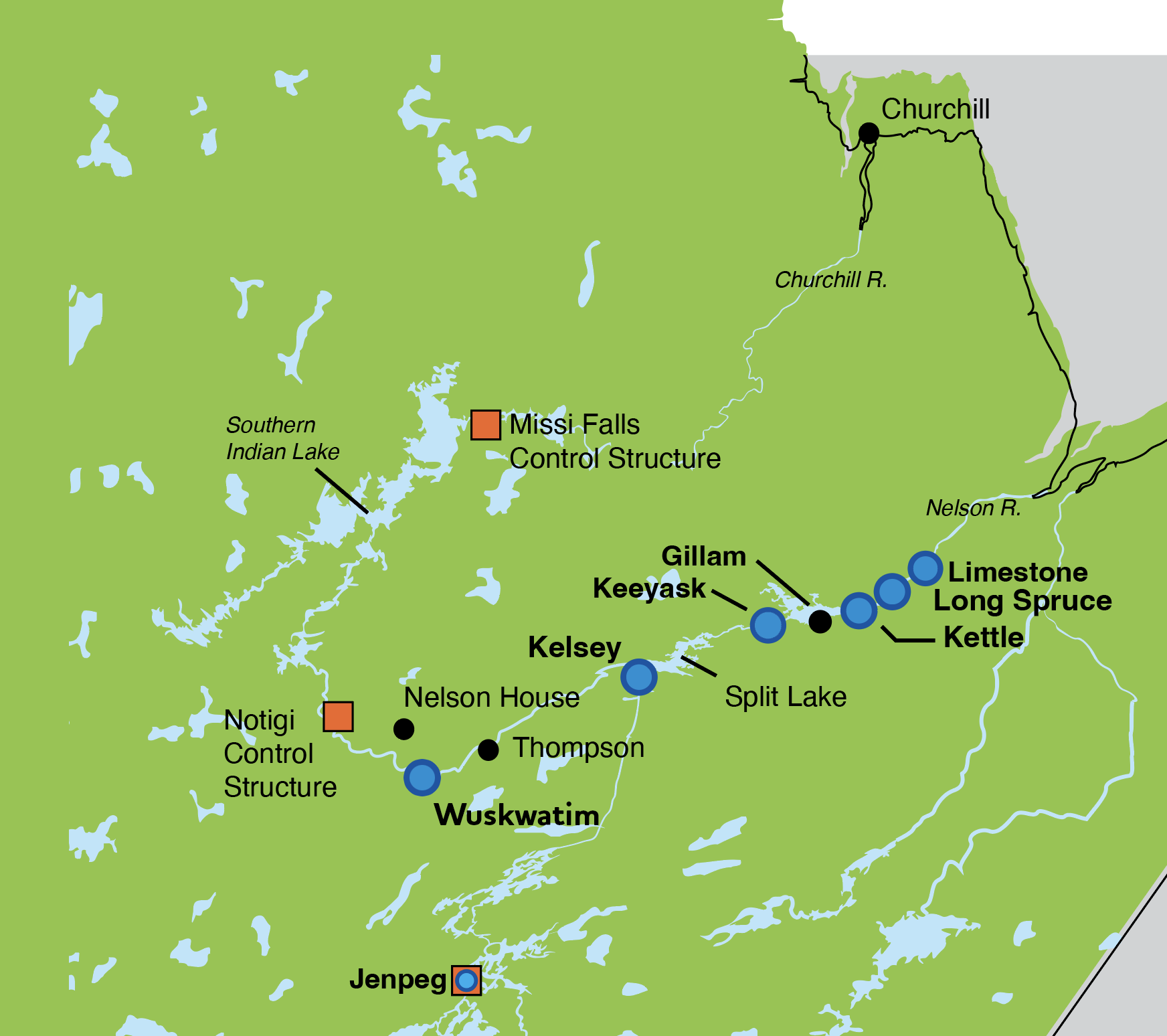
Map of Churchill and Nelson Rivers with control structures and generating stations.
Enlarge image: Map of Churchill and Nelson rivers with control structures and generating stations.
Churchill River (Southern Indian Lake to Hudson Bay)
Spring melt started in early May with flows lower than last year. Forecasts of spring flows are highly variable at this time and will be heavily dependent on weather conditions over the next two months. Inflows from Saskatchewan to Southern Indian Lake (SIL) are about 22,000 cubic feet per second (cfs). The level of SIL is below average for this time of year at 844.8 ft above sea level (ASL) and is expected to rise modestly through May and June.
Flow on the Churchill River entering Southern Indian Lake is near the lowest it has been in 40 years.
Churchill River Flows at Churchill are estimated to be 6,500 cfs and are forecasted to decrease over the next month with continued dry conditions. Flows at CR30 are currently forecasted to peak in late May to mid-June depending upon the timing of local snow melt. Under average conditions, flows are forecasted to peak at approximately 13,400 cfs by early June.
Outflows through Missi Falls Control Structure are 750 cfs.
Burntwood River
Much of the Churchill River flow is diverted out of SIL through the Churchill River Diversion via the Notigi Control Structure to the Rat and Burntwood Rivers. Flows through Notigi are at 15,000 cfs.
Nelson River
Nelson River flow is below a 1 in 10-year low and will increase due to recent above average precipitation in the south part of the basin.
Lake Winnipeg water level is 712.6 ft ASL and is expected to rise slightly over the next week. Kelsey flows are at 47,000 cfs, which is lower than last year (68,081 cfs). Split Lake water levels will drop slightly from 545.3 ft ASL to 544.9 ft ASL over the next week.
Manitoba Hydro closely monitors water supply conditions across the entire Nelson-Churchill River drainage basin and updates its forecasts and operating plans weekly to ensure adequate energy supply. Changes in precipitation can impact Manitoba Hydro’s operations and water levels across the system. Drought is a central focus in Manitoba Hydro’s planning, design and operation of its generating stations, reservoirs, and interconnections.
Long-term precipitation forecasts are unreliable and there remains uncertainty in water level projections for the late spring and summer period. This is the fourth and final Spring Outlook.
*Spring flows depend on how long it takes for snow to melt (for example, warm temperatures will cause a fast melt and higher water flows, while cooler temperatures will cause a slow melt and moderate flows for a longer period of time). Conditions can also change rapidly if a large rainfall or snowfall event occurs. Outlook information will be updated as conditions change.
The Outlook is based on a combination of current and forecasted weather data from Environment and Climate Change Canada; recent and historic streamflow conditions based on both federal and Manitoba Hydro data; Manitoba Hydro regulation models for Reindeer Lake and SIL; snow surveys conducted by Manitoba Hydro; and snowpack estimates from satellite data.
If you have any questions or concerns, please contact:
Waterway Community Engagement
204-360-3505
WCE@hydro.mb.ca